[ngg src=”galleries” ids=”1″ display=”basic_thumbnail”]
Trips
Aegean Crossing
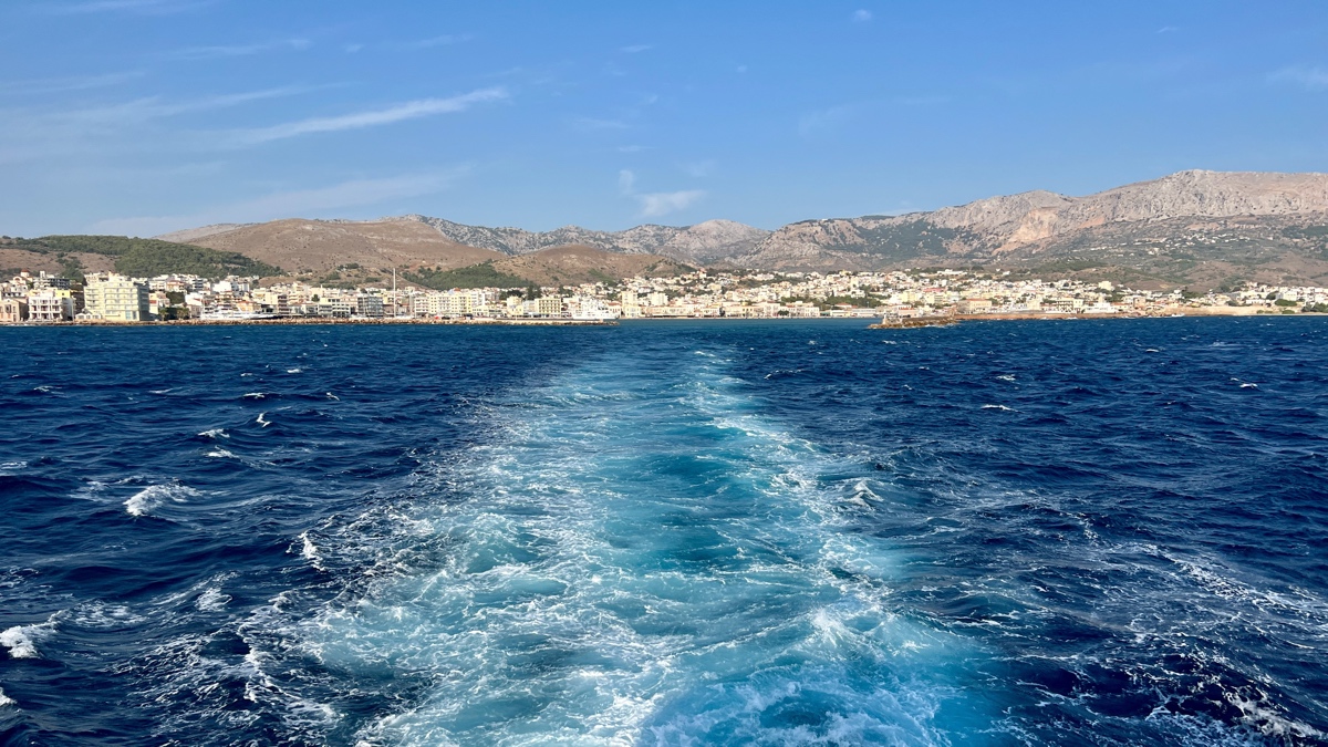
Sailing to Çesme from the island of Chios.
Goodbye beloved Greece! 🇬🇷
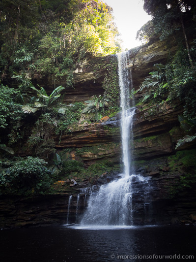
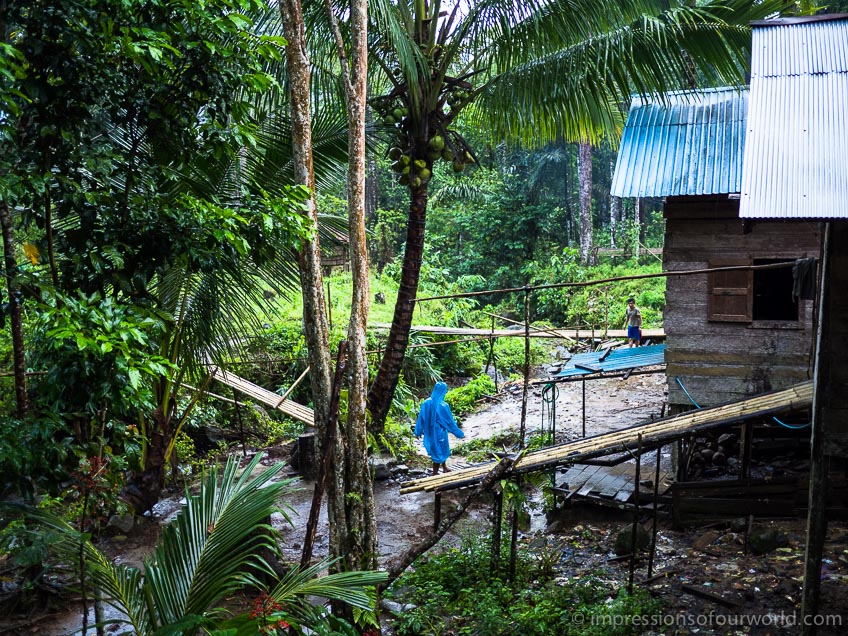
Wind and Rain Bridges of the Dong

Chéngyáng Wind and Rain Bridge in northern Guangxi.
The seventy-eight metre long Chéngyáng Wind and Rain Bridge is the most exquisite bridge built by the Dong, an ethnic minority living in China’s northern Guangxi Province, among other places. Several more of these bridges, albeit smaller ones, connect a number of pretty Dong villages in the area. Another typical feature of these villages is their drum tower, a pagoda-like tower which serves as a religious and meeting place. The Dong are renowned carpenters and not a single nail is used in their constructions. Although concrete has found its way here, like everywhere in China, fir logs are still being prepared on the village square, to be used in the construction of some impressive new wooden houses.
Transit Vietnam

Arriving in Hanoi at break of day, the end terminal of the SE2 and SE4 Reunification Line trains.
Train travel in Vietnam is pretty straightforward as there’s only one line between Saigon in the south and Hanoi in the north. Traveling the whole length of the Reunification Line would take a time-effective two nights and one day, in a comfortable soft sleeper coupe. The only thing stressful about it is buying the tickets in the huge ticketing hall of Saigon Station, where little English is spoken and queues are long.
Our plan was to transit through Vietnam rather quickly, but we did split up the long journey by stopping over in Phan Thiet and Hoi An for a few days. The most time, however, we spent in Hanoi sorting out our Chinese visa. It took four visits to the embassy and a lot of waiting and improvising, but after five days we had our visas in hand and could finally buy our train tickets to Nanning. Interesting detail: in order to get a Chinese visa in Hanoi you must have a valid ticket to China, but to buy a train ticket to China you must have a Chinese visa (guess how we solved that one).

Our favourite bia hoi corner in Hanoi’s Old Quarter. A great place for people watching in the late afternoon, or waiting for your visa…

Bia hoi is Vietnamese for draft beer, a simple brew which even An likes, often sold from holes in the wall for only 5000 dong a glass (about 20 eurocent).
Nostalgia

A restaurant in the Boeung Kak area, the interior looking exactly as it did ten years ago.
Veteran backpackers will remember Phnom Penh’s lakeside, a cluster of ramshackle guesthouses and restaurants on the south shore of Boeung Kak. Many of these had lounge docks built over the water with great views of the lake. The favourite pass time here used to be watching the sunset from a hammock or lounge chair, while drinking chilled Angkor Beer with Bob Marley stuck on repeat. I’ve stayed in Boeung Kak myself a few times, during my Wander Year ten years ago and also on my first trip with An in 2008. Not long after that, the lake has been drained and the area slated for redevelopment.
Although this time we were staying in a boutique hotel in central Phnom Penh, we went to have a look at what has become of the city’s former backpacker hangout. Obviously, many businesses have disappeared or moved to another location, including the popular Number 9 Guesthouse. Number 10 Guesthouse is still around, but the view of the lake has been replaced by a wall. Accomodation is dirt-cheap, as the few remaining guesthouses are trying to attract customers in order to survive. A handful of nostalgic travelers still hang around, but the once so lively lakeside has become depressingly run-down and quiet these days…

Watching the sunset from the now gone Number 9 Guesthouse. This picture was taken ten years ago, during my first visit, and appeared in my City of Sin blog post if someone still remembers. (Sorry for the low resolution, I don’t have the original image with me.)

Today, the view of Boeung Kak looks like this. In the next few years, a whole new neighbourhood will rise here.
Off the Rails

Old train sheds, built by the French, are crumbling behind Battambangs railway station.
Apart from the bamboo train, there has been no Cambodian train service for over six years. On the old station clock in Battambang it is always two minutes past eight, the rails have been overgrown and the space between them reclaimed by villagers to play volleyball. But things are about to change. The Chinese are rebuilding the country’s decrepit railways (with a lot of Australian money) and within the next few years trains will be riding again on the south line between Phnom Penh and Sihanoukville. In a later stage, service on the west line to Poipet will also be restored for the first time since the Khmer Rouge destroyed it. One day, it might even become possible to travel all the way from Bangkok to Saigon via Phnom Penh, the missing rail link between Singapore and China.
But until then buses are the only option. Our route runs along the south coast of the Tonle Sap River, past Battambang and Kompong Chnang, a part of the country we’d skipped on previous trips. As always we enjoyed Cambodia, for its countryside that is dotted with buddhist temples, its warm people and that frontier feeling one gets while traveling here.
Sukhumvit Skyline
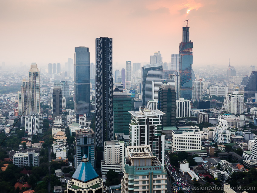
A new high-rise building is being constructed in Bangkoks Sukhumvit neighbourhood.
Bangkoks cityscape is changing all the time and it’ll only get more impressive as new buildings are erected around town. I love being in the Thai capital, it’s one of the few cities in Asia that I could actually live in. A modern metropolis that’s buzzing day and night, very international and easy to get around in by skytrain or metro. Not to mention the food! We stayed for five days this time, before moving on to Cambodia. But leaving Bangkok, never easy…
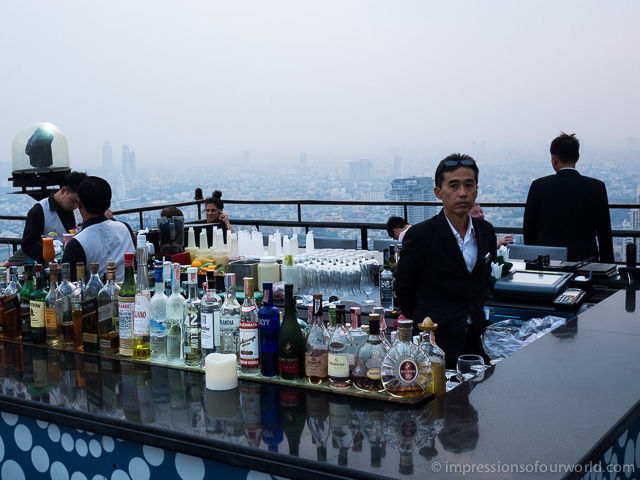
The best views of the city you get from one of its rooftop bars.
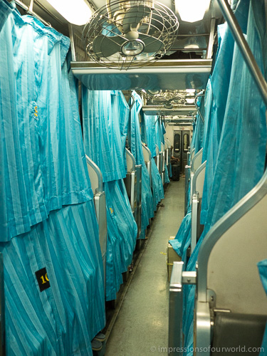
The Antarabangsa Ekspres
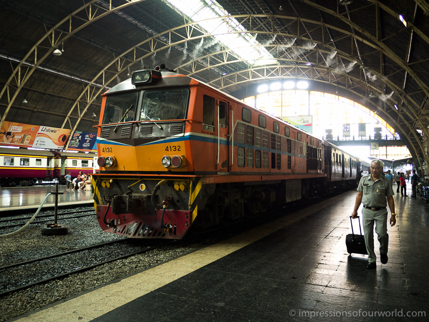
The Antarabangsa Ekspres has arrived in Hualomphong Station, Bangkok.
The international Antarabangsa Ekspres arrived in Hualomphong Station at 9:30 in the morning. The journey from Butterworth in Malaysia to Bangkok took around twenty hours, including border formalities. Thai sleeper trains are very comfortable, with one lower and one upper berth on each side of the aisle. During the daytime, these are converted to seats. If, like us, you didn’t bring your own food, you can order dinner on the train and an attendant will serve it at your table. The only thing missing was a bottle of wine, but this we could buy duty-free at the border post…
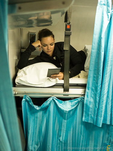
An in the upper berth, reading throughout the journey as usual.
Curtains provide some privacy during the night.
Food Capital

This popular food stall on Chulia Street is turning out hundreds of plates of Wan Tan Mee every day; tasty noodles served with wonton dumplings and a dark soy sauce dressing, garnished with barbecued pork slices.
Traveling, to me, is as much about the food as anything else. Although I liked George Town for more than its eating scene, our days here often revolved around where we’d have our next meal. Malaysia’s food capital, as it is called, has a great selection of unique street food dishes to explore, as well as some very fine restaurants. Penang is primarily Chinese, which is reflected in its cuisine, but there’s also Indian and Peranakan influences. Some typical dishes we’ve been trying: Penang Laksa (probably the most famous), Char Koay Teow, Wan Tan Mee, Roti Canai and the ubiquitous Mee Goreng.

Some restaurants are just eating halls lined with different cooking stalls, each one specialising in a particular dish. Here we’re trying Char Koay Teow (garlicky noodles with prawns) and Penang Laksa.

Penang Laksa: rice vermicelli in an incredibly aromatic fish-broth, with hints of prawn paste, lemongrass, ginger, mint, and so much more.

Besides street food, George Town boasts a few excellent restaurants. The best one is probably Kebaya, part of the Seven Terraces Hotel, housed in a nicely restored row of seven heritage buildings.

Fine dining at Kebaya. As a starter, we had the Otak Otak (red snapper pastries) and Ban Xeo (crispy wafers stuffed with shredded chicken, crispy tofu and stir-fried vegetables in a tamarind sauce). Simply the best dinner of our trip so far.
Malaysian Holiday

Macho drivers in their pink fluffy trishaws, waiting for tourists in front of Melaka’s Dutch-built Stadthuys. This could count as WTF-moment of the day.
After Borneo we took a holiday in a holiday on Peninsular Malaysia. This is the most modern part of the country and very easy to travel in. The tourist crowd you meet here is similar to the one in Vietnam or Thailand; think sleeveless beer shirts and fishermans pants, although the new trend seems to be open side shirts through which people can admire your sixpack or bra…
We quite enjoyed spending a few days in metropolitan Kuala Lumpur, the first big city on this trip. After KL we followed the westcoast tourist trail from Melaka to Penang, stopping for cool air, hot tea and sweet strawberries in the Cameron Highlands. Easy, and relaxed.
BSB Stopover
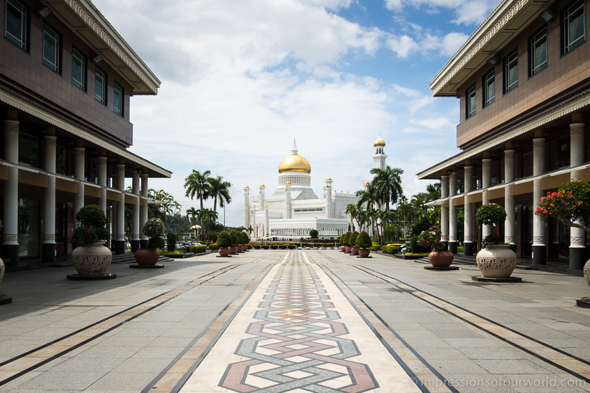
The Omar Ali Saifuddien Mosque in the centre of Bandar Seri Begawan (BSB).
Brunei was a short two-day stopover on our way between the Malaysian states of Sabah and Sarawak. Except for shopping, we found there’s not much going on in BSB and it was by far the least lively capital that we’ve been to in Asia. But still interesting to get a glimpse of life in the worlds last sultanate, a tiny state that is thriving on oil money.
Mount Kinabalu

Trekkers on the descend from Mount Kinabalu’s summit. As the sun rises, the mountain is casting its shadow on the clouds and the landscape below.
Climbing Mt. Kinabalu, Borneo’s highest mountain, was high on my personal to-do list for this trip. The mountain is part of Kinabalu National Park and the trek to the summit, at 4095m elevation, typically takes two days. It’s a very popular trek, but since not everyone walks at the same pace the crowds didn’t bother us much.
On the first day, the trek from park headquarters to the basecamp at Lapan Rata, a long 1400m ascent, took us about four hours. Like most people, we stayed in the lodge run by Sutera, a company that basically has a monopoly on the mountain as there’s no other accommodation and camping is not allowed. Although expensive (all food and provisions have to be carried up by porters), we found everything was well organised and it was certainly the most luxurious trek we ever did, with great meals after the hikes and a comfy dorm bed during the night.
At two o’clock in the morning, everybody got up to begin the trek to the summit, some eight hundred metres above camp. The wind got more and more fierce as we gained elevation and temperature dropped significantly on the exposed rockfaces. For the first time since we left Belgium, we needed our warm clothes. As planned, we made it to the summit just in time to see the sunrise at six in the morning. No need to say the view over Borneo was breathtaking. After the mandatory photos, we returned to Lapan Rata for our second breakfast (An’s favourite meal of the day) and to start the hike back to headquarters.
Although we didn’t find the Kinabalu climb to be particulary difficult, certainly no more than for instance Fansipan in Vietnam or Rinjani in Indonesia, the 2300m of vertical descent on day two was a real leg killer. The next few days we took it very easy…
Borneo’s Lost World
Guide Ijan in the jungle of Maliau.
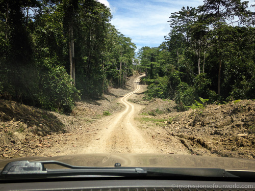
Somewhere deep in Borneo’s state of Sabah, there is a hidden world that was only discovered in 1947, by a British pilot. The Maliau Basin, a remote area the size of Singapore, is covered with primary rainforest and, except where the Maliau River exits the basin, is surrounded by steep slopes (you can clearly see its shape if you zoom in on the map). It has never been inhabited and it wasn’t until the eighties that the first expedition took place. To date, only a few thousand people have set foot here, and we are so lucky to be among them.
Today, the Maliau Basin Conservation Area is a strictly protected wilderness. Trips here are deliberately cost-prohibitive, so only real nature lovers are visiting (actually, we didn’t see anyone in four days). To keep the cost reasonable, we didn’t use a trekking agency but organised our trek directly with the Maliau staff at their office in Tawau. This takes a few days but is well worth the savings. We also carried our own stuff, including food for four days, that we cooked ourselves at the camps. So the biggest costs that remained were the transport (you need a 4×4 to get into the park, at least for now) and the guide.
The first day around noon, our driver dropped us at Agathis Camp. The camp was deserted and looked like it hadn’t been used in a while. We reckoned our guide would be arriving soon, so ate our lunch and took a short nap. After two hours, however, there was still no sign of a guide. We started to worry a little. Maybe we hadn’t made ourselves sufficiently clear at the gate, as the staff didn’t understand much English. Since we didn’t fancy hiking back twenty eight kilometer on an exposed jeep track, and our cell phone was pretty useless without a signal, I decided to force my way into the camps staff room. Inside, much to my relieve, there was a UHF radio mounted against the wall. ‘Two trekkers waiting for guide in Agathis Camp, over. Two trekkers waiting for guide in Agathis Camp, over.’ After a few tries I got a creaking response, which I didn’t fully understand, but at least they knew we were here. Half an hour later we heard a jeep stopping, and met our guide Ijan.
Over the next three days we hiked approx forty-five kilometers of trails. At night we slept in basic camps, one of them built by a Camel Trophy crew in the nineties. Although pretty spartan, the camps were a luxury after a day in the jungle (and out of reach of the leeches). The trek itself was pretty strenuous, especially on day three, when we made an eleven kilometer detour to Maliau Falls. After scrabbling down a difficult, slippery trail, an impressive seven-story waterfall revealed itself, creating a rainbow where the water plunged down into a black pool. There were no other people, only the jungle surrounding us. This had to be one of the most beautiful and serene places we’d ever been in Southeast Asia. Over the course of four days, Ijan guided us to three more waterfalls: Aktob Takob, Giluk and Ginseng Falls, each one spectacular in its own way.
Maliau is home to a lot of wildlife and our guide was pretty good in spotting it. That would go like this:
Ijan: ‘Look, snake! See it?’
We: ‘Nope, where?’
Ijan: ‘There, in the tree, green snake!’
We: ‘Ehm, nope.’
Ijan: ‘In the bamboo, see it?’
We: ‘Nope.’
Ijan: ‘Oh, it’s gone now, let’s go.’
But we were able to spot quite a few other animals: sambar deer, barking deer (after hearing its terrifying scream echo through the forest a few times, we were glad it was just a deer), a few red monkeys, and civets that came sneaking around in the camp at night. Most of the time we only got a short glimpse and the animals disappeared before I could grab my camera. There’s also pygmy elephants living in Maliau, but unfortunately we didn’t see any (although we did come across their dung…). The most impressive, though, were the hornbills: giant birds sounding like electrical drones when they came zooming over. Beautiful.
Will Maliau remain a lost world forever? Probably not. The road from Tawau has already been paved two years ago and works are in progress to upgrade the access road into the basin. Staff told me this road will be paved too by the end of 2016, which will allow more people to visit as a 4×4 won’t be necessary anymore. Some even dream aloud about a nine kilometer death ride… Enjoy it while it lasts.
The access road into Maliau Basin.
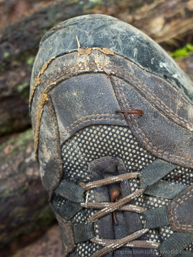
Everytime we stopped moving several leeches would attach to our shoes, trying to reach our flesh for a bloody meal. Luckily, we’d gotten ourselves a pair of leech socks which were very effective in stopping the slimy bastards.
Dormitory at Agathis Camp (which we had completely to ourselves).
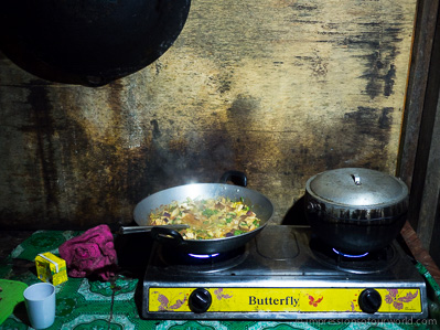
Cooking up an improvised veggie curry with rice in Nepenthes Camp.
Giluk Falls, one of Maliau’s four beautiful waterfalls.
Crossing a jungle stream of clear water that looks like black tea.
Ginseng Falls, with An wearing her funky leech socks.
On the last day, we did spot another snake (and before our guide did). This large, venomous green viper came sneaking down on Ijan while he was sitting against a tree, having a snack. An noticed that Ijan was about to be turned into a snack himself when we were about to get moving again, and the snake had approached him to less than two metres.
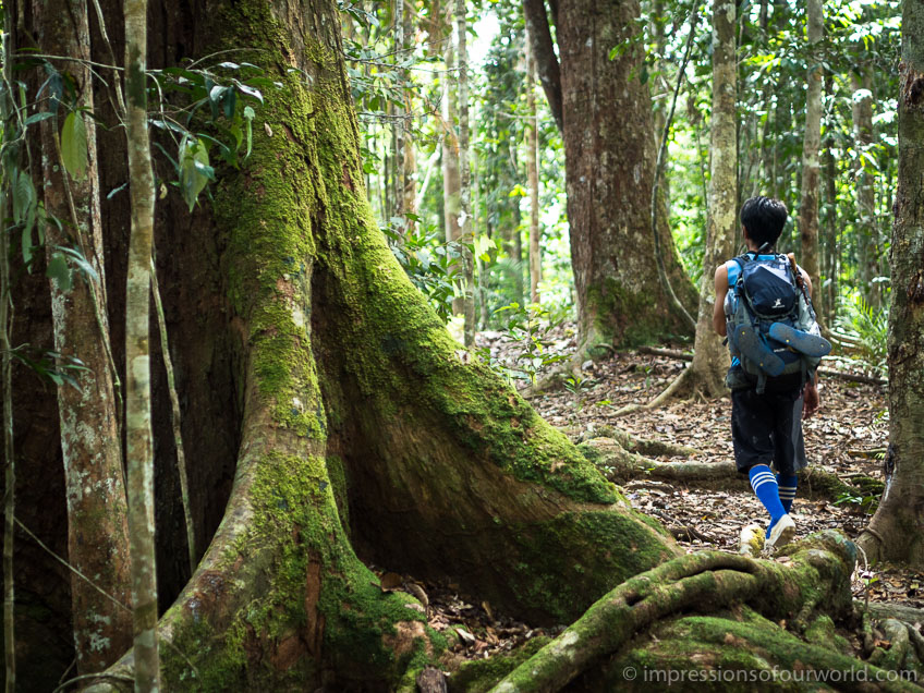
Bornean Reality Check

Buttress roots of a giant tree in Niah National Park, Malaysian Borneo.
I’ve always had these romantic visions of Borneo as a rainforest covered island with black rivers snaking through its dark interior. An island that is home to tribal people, exotic birds and plants, and creepy insects crawling across the forest floor.
But reality is never as romantic as you imagined. Although such places still exist, both Kalimantan and Malaysian Borneo have been heavily deforested in the past decades, with primary rainforest being burned and logged to make way for agriculture. In the seventies and eighties Indonesia even had a transmigrasi program to move poor farmers to Kalimantan, so they could clear and work the land in order to feed the country’s ever-growing population. But with the jungle gone, the soil quickly eroded and became unfertile. Nowadays, Borneo is the worlds largest supplier of palm oil and monoculture has been taken to the extreme. We’ve been riding past hundreds and hundreds of kilometers of palm oil plantations; sometimes it felt like the whole island is covered with rows of palm trees.
At many ethnic longhouse villages, like Kampung Patrick Libau where we stayed one night, literally everyone works in the palm oil plantations. Modern amenities like cell phones, televisions and internet have made their way here, and the economic development provides these people with an income. However, it’s not always helping them forward. They’re selling (or sometimes losing) their land and their soul to powerful corporations, and with it the forest they’ve always depended on. So people get stuck working in conditions that are far from ideal.
What’s most depressing though, is the ongoing loss of rainforest that has existed and survived for millions of years and is the habitat of an incredibly large variety of fauna and flora, including the endangered orangutan. Not only are these animals losing habitat, they’re often injured or killed in the deforestation process, or when trespassing on plantations or fields in search of food. At Tanjung Putings visitor centre, we’ve seen pictures of orangutans that have been burnt alive.
Palm oil is used in a large variety of products (chips, shampoo, you name it), so it’s not easy to avoid. Only since this year, the EU is requiring companies to correctly mention the use of palm oil on their product labels. Maybe we should start thinking twice before buying these products in the supermarket, or that fancy garden set made of tropical hardwood…

Only from the sky you can see the true extend of Borneo’s palm plantations.
Sail another Day

Boarding the international speedboat from Nunukan to Tawau. Given its name, the Labuan Express, I suspect in another life this boat used to ply the waters around Labuan Island.
It wasn’t our week. After finally making it to Tarakan, we missed the direct boat to Tawau (Malaysia). Indonesian immigration had closed an hour or so before departure and, of course, we couldn’t board without our exit stamp. Time for Plan B. We got on a speedboat to Nunukan, still in Indonesia, but only to get stranded again because the onward speedboat to Tawau had already departed. Little English was spoken here and depending on who we asked, the next boat would leave at seven, eight or nine o’clock the next morning. To be safe we went to the port as early as possible, so early that we were assigned seat number 1 and 2. It turned out the speedboat would depart at eight, giving us plenty of time to have one last plate of mie goreng, before leaving Indonesia.
Fly another Day

An getting a little bored of posing…
On every big trip, we seem to have at least one encounter with the police. This time we arrived at the airport of Balikpapan with (what would turn out to be) falsified tickets. Appearantly, the travel agent we bought our tickets from that morning had deliberately booked us on tomorrows flight, edited the tickets before they were printed and overcharged us for this special service. So we were screwed, as the airline refused to check us in and changing the ticket dates would incur a hefty fee. After some discussion, the staff suggested we’d file a complaint against the travel agent with the airport police.
The police was quite helpful and after explaining our case, half the corps escorted us back to the travel agent, whose face turned pale when we entered his office accompanied by five law officers. The first thing the police did was taking pictures with their phones of everything and everyone. This, however, quickly escalated into a lenghty photo shoot of An posing with every single officer, which was great fun for everybody except for the travel agent who just sat there, undergoing it all.
To cut a long story short, the police did their job and everything turned out fine; we were able to catch the afternoon instead of the morning flight to Tarakan, at the travel agents expense. Why we hadn’t noticed that the dates were missing on our tickets, we don’t know, but maybe the fact that we rather impulsively booked this flight at six in the morning after arriving in Balikpapan on the horror bus, had something to do with it…
Regenwoud
Ook na aankomst in het dorpje Salang Ai bleef het nog uren regenen, terwijl wij onze spullen probeerden te drogen rond het vuur.
Loksado, een dorp in de Meratus bergen van Kalimantan, staat bekend om zijn mooie jungle-treks. Veel westerse toeristen vind je er niet, of toch niet in het regenseizoen. Onderweg ernaartoe ontmoetten we slechts één Duitser, Johan, waarmee we aan een driedaagse trekking begonnen.
‘It will be quite a strenuous trek,’ zei Olaf nog tegen Johan voordat we vertrokken, met een blik op diens opkomend bierbuikje.
‘I’m quitz vit,’ antwoordde Johan, met die rare glimlach van hem.
‘Do you have a sweater?’ ging ik verder, want het kan ’s avonds best koud worden in de bergen. ‘A rain coat? Long trousers? A sleeping bag?’
Niets van dit alles bleek Johan bij zich te hebben, enkel een t-shirt, short en wat hij noemde ‘trekkingsandalen’. Maar hij was er niettemin van overtuigd dat hij de tocht zou aankunnen.
Onze gids Amat had niet gelogen over de fysieke moeilijkheid van de trek. De eerste uren ging het steil omhoog. De inspanning en de vochtige hitte van de jungle maakten ons meteen drijfnat. Het werd ook snel duidelijk dat Johan niet zo vit was als hij dacht. Puffend en hijgend als een stoommachine liep hij achter ons aan. Telkens als we een rivier overstaken hingen er dertig bloedzuigers aan zijn voeten en kuiten, en het aantal muggenbeten op zijn blote vlees was niet te tellen. Maar het moet gezegd worden: hij klaagde weinig en Olaf en ik konden volop genieten van de wilde jungle met haar torenhoge bomen, planten die op planten op bomen groeiden en het jungle-fruit dat voor het oprapen lag.
Tot het begon te regenen. Gieten. Urenlang stortten er bakken water uit de hemel. We probeerden onze rugzakken zo goed mogelijk te beschermen met onze regenjassen, maar zelf waren we in een mum van tijd drijfnat. Alleen die arme Johan, in zijn t-shirt, herinnerde ons eraan dat het altijd nog erger kon.
Na uren lopen in de regen kwamen we eindelijk aan in Salang Ai, het piepkleine dorpje waar we zouden overnachten. (Elf families rond een traditioneel long-house, dat is in de jungle de naam dorp waard). De moed zonk in onze drijfnatte schoenen toen we merkten dat onze slaapzakken en reservekleren toch vrij nat waren geworden.
Veel comfort vonden we niet in onze homestay, we sliepen op de harde plankenvloer en een toilet was er niet – of zoals Amat het verwoordde: ‘toilet is anywhere’. We waren dan ook niet verbaasd dat Johan de volgende ochtend wilde terugkeren. Eerlijk gezegd vonden Olaf en ik het niet zo erg, want de regen had ook onze moed weggespoeld. Gelukkig leidde Amat ons via een andere route terug naar Loksado en werd het toch nog een interessante tweedaagse trek. Maar volgende keer nemen we toch geen Duitsers meer mee, hoe vit ze ook beweren te zijn.
Airborne

Boarding an ATR 72 propeller plane for TriganaAir flight IL125. What I like about propeller planes is that they fly below the cloud level, so we got a nice aerial view of Kalimantan (although it’s depressing to see the scale on which rainforest is being replaced with palm oil plantations). Propeller planes are also more ecological than jets.
Many villages in the jungle-covered interior of Kalimantan are accessible only by boat or (bush) airplane. The few roads that do exist are often in bad condition, making transport incredibly slow and uncomfortable. The night ride from Kandangan to Balikpapan was a grueling twelve hour journey in a hot bus with barely enough leg space for the average Indonesian (who is half as tall as us), no head rests and reclining seats that had permanently stopped reclining a long time ago. To make sure that this wouldn’t keep us from sleeping the bus was also filled to the brim with noisy, chain-smoking passengers.
And that was the easy part. The onward journey to Tarakan, close to the Malaysian border, would have taken another twenty hours by road. Our weary bones were glad to get on a one-hour LionAir flight instead. It saved us some time on our Indonesian visa’s too, as they’d soon be running out.
Two other flights we took: TriganaAir IL125 from Pangkalan Bun to Banjarmasin, to avoid another twelve-hour Indonesian bus ride, and the long stretch to Peninsular Malaysia as there are no direct ferries from Borneo anymore.
Orangutan Spotting

A sixteen year old non-dominant male orangutan in Camp Leaky. Male orangutans are eight times stronger than us, humans, weigh up to 150kg and become 1m50 tall.
The year was 1971. A young twenty-five year old woman, together with her husband, arrived in the rainforest of Borneo and founded Camp Leaky. The next thirty years Dr. Galdikas devoted her life to the field study and protection of orangutans, the great ginger apes that are only found on Borneo and Sumatra. Not only was her research groundbreaking, she also started a rehabilitation program for orphaned and ex-captive orangutans. The program was a success and several new generations of so called ‘semi-wild’ orangutans have been born here over the years, living happily in the jungle alongside their wild cousins. Protection of the orangutans habitat is essential, now more than ever, as more and more of Borneo’s rainforests are being logged or replaced with palm oil plantations.
Today, Camp Leaky is part of Tanjung Puting National Park and can be visited by boat. We chartered a klotok, a basic wooden houseboat, and spent three days on the Sungai Sekonyer river. It became one of the highlights of our Indonesia itinerary, a truely unique experience, floating through lush jungle and spotting wildlife on the river banks, while relaxing in a comfy chair on the deck or having a nice meal prepared by our own personal cook. At night we slept on the deck under a mosquito net and in the morning we were awakened by the wonderful call of the gibbon, at 5 AM, still better than the usual call for prayer at sunrise time…
But the main reason to come to Tanjung Putin is of course to spot orangutans. We went ashore to visit Camp Leaky and two other feeding stations. These are in fact little more than bamboo platforms on which rangers empty a few baskets of fruit at feeding time, once a day. If you’re lucky, a few (semi-wild) orangutans will materialise from the jungle after a while. Some of them are quite shy, but as a visitor you can still observe them from pretty close, maybe five to ten meters and without a fence. It might also be that there’s plenty of food in the forest at the moment and no apes come down to the platform at all, though you can always return the next day and have more luck (like we did). All in all we’ve been very lucky and have seen many orangutans, including one dominant male in Camp One. And since we visited during the rainy season, there were no crowds, we even had one station to ourselves for a while.

A gibbon stealing as many bananas from a feeding platform as he can carry, before disappearing into the trees again.

Ah, the life of a proboscis monkey, watching the sunset from a tree along the river bank, without any shame…

Spotting crocodiles and other wildlife from our comfy chairs.
Selamat Datang di Sampit
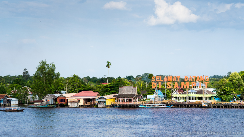
Welcome to Sampit, on the island of Borneo!
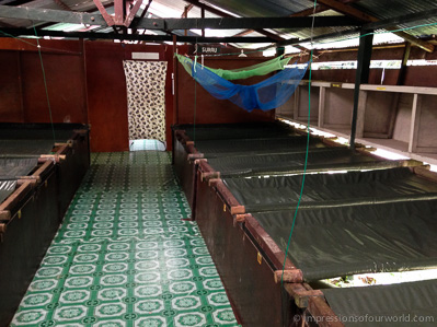
We boarded the Leuser, a passenger ship operated by the state-owned Pelni company, in Surabaya to cross the Java Sea to Kalimantan. This journey to the Indonesian part of Borneo took a long twenty-seven hours, but was very comfortable as we traveled in a nice two-berth cabin. Unfortunately, this way of slow travel is becoming less of an option nowadays, as more and more ferry routes in the world are being replaced by low-cost flight connections.
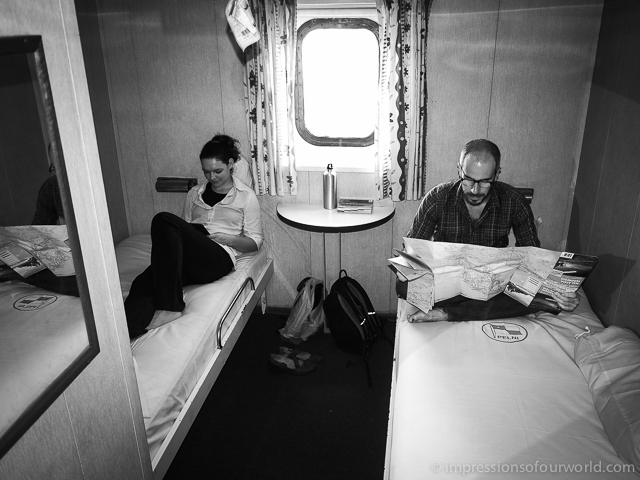
Old-school travel in a first class, two-berth cabin with ensuite bathroom and all meals included, at the same fare as a cramped AirAsia flight on the date we traveled. A bargain.
Het Blauwe Vuur
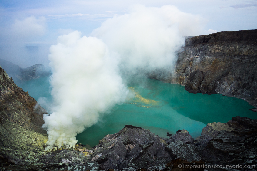
De krater van de Ijen vulkaan in het oosten van Java. Het kratermeer is het grootste zure meer ter wereld, het water is zo zuur dat je kleren er gewoon in zouden oplossen (en jijzelf waarschijnlijk ook).
De krater van Kawah Ijen is continu gevuld met gele zwaveldampen die zo heet zijn dat er blauwe vlammen ontstaan. Het ‘Blauwe Vuur’, zoals men het hier noemt, is enkel in het donker te zien. Dus vertrokken wij na middernacht naar de krater voor een steile klim naar de top van de 2600m hoge vulkaan.
De sereniteit van onze nachtelijke tocht werd enigszins verstoord door de honderden lokale toeristen die samen met ons naar boven trokken; hier in het weekend komen was duidelijk niet het beste plan. Maar het was grappig om de macho-Indonesiërs, die ons eerst met veel vertoon waren voorbijgestoken, al snel achter ons te laten. Als we iets in de Himalaya hebben geleerd is het wel hoe je een berg op moet lopen: langzaam. De parabel van de haas en de schildpad is niet zomaar een verhaaltje.
Eenmaal op de top van de vulkaan begon de echte uitdaging: via een steil, glibberig pad omlaag de krater in om tot vlakbij het Blauwe Vuur te komen. Bij zwaveldampen denk je meteen aan stank, maar er is nog veel meer: het gas doet je ogen tranen, snijdt je ademhaling af en brandt in je keel. Terwijl wij beneden ons best deden om zo goed mogelijk uit de giftige dampen te blijven, liepen de mijnwerkers – die samen met ons in de krater waren afgedaald – de dikke gele wolk in tot op het punt waar de zwavel wordt afgezet. Wij kropen vermoeid weer naar boven, maar ondertussen zeulden zij veertig, sommigen zelfs tot tachtig kilo zwavel op hun schouders mee naar boven. En dat voor een luttele achthonderd rupiah per kilo (een goeie vijf eurocent). Die tocht doen ze bovendien twee of zelfs drie keer per dag.
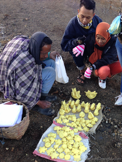
Gelukkig kunnen die arme mannen een beetje van het toerisme profiteren, door figuurtjes van zwavel te verkopen. De Indonesiërs waren er dol op en zeulden hele zakken mee naar beneden. Ironisch genoeg was het beeldje van de schildpad hun favoriet…
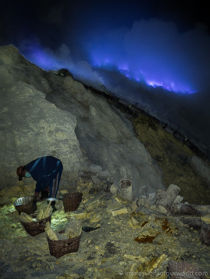
Nog voor zonsopgang vult een mijnwerker zijn manden met zwavelblokken voor de eerste keer, met het Blauwe Vuur op de achtergrond.
Sommige mijnwerkers verdienen iets bij door zwavel te smelten en in vormpjes te gieten om te verkopen.
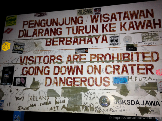
Een bord op de top van de krater waarschuwt bezoekers, maar wordt door iedereen genegeerd.
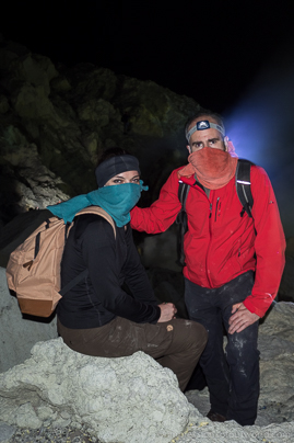
Een vochtige handdoek maakt het ademen iets gemakkelijker, maar houdt lang niet alles tegen. Het heeft dagen geduurd vooraleer de zwavelgeur uit onze neus was verdwenen.
East Java
While the ferry is about to dock, the evening call for prayer sounds from a mosque in the distance with Kawah Ijen as the backdrop. We’ve crossed the narrow Bali Strait to East Java, the islands most natural region and home to no less than forty-five active vulcanoes. Mount Semeru is the highest and together with Merapi the most active, Bromo may be the most beautiful, but on this trip we’ll be visiting Ijen.
Tirta Empuls Holy Springs
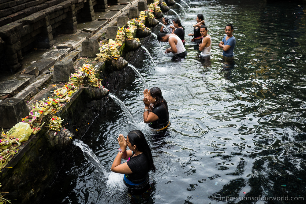
Holy spring water gushes out of waterspouts at the Balinese temple of Tirta Empul. The springs are believed to have magical powers and people have been bathing here and adorning the pools with colourful little offerings for more than a thousand years.
Prologue
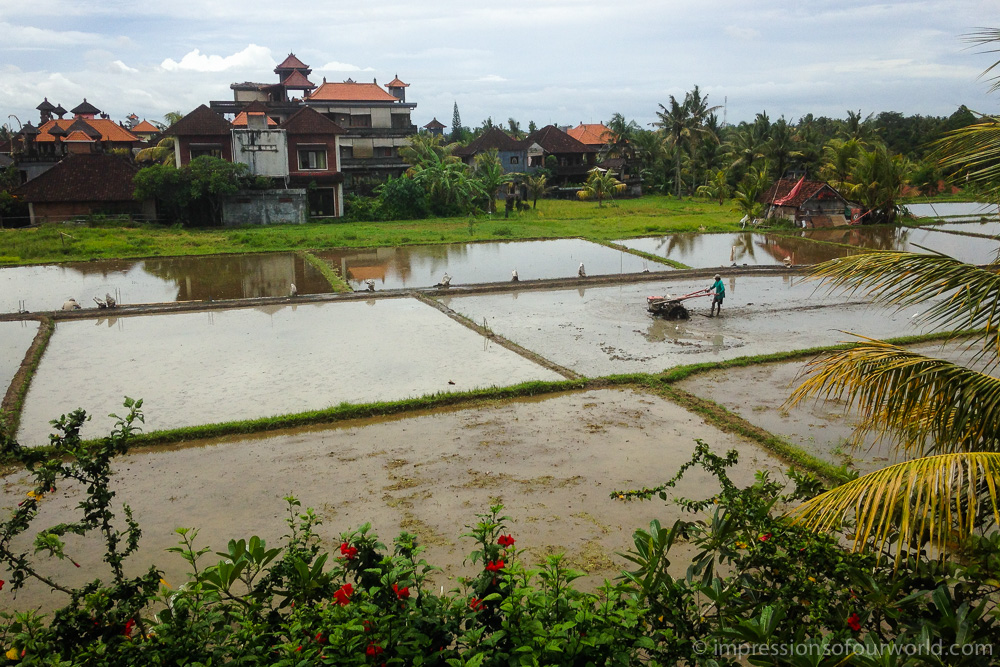
Plowing rice paddies in the rain, by hand-tractor. This photo was shot on my iPhone, from our balcony in Ubud.
After ten years of traveling to Asia, from the islamic countries in the Middle East and Central Asia to the Indian subcontinent and tropical South East Asia, I’ve covered quite a bit of ground, and in the meantime, so has An. But it’s a vast continent and many blind spots remain on our travel maps. This new trip is about connecting the dots, places we’ve skipped on previous trips, mostly due to lack of time or because they were too far off our route, as well as a few countries we’ve never been before.
To start this trip we’ve taken a one-way flight deep into South East Asia. We chose Bali as our starting point because it’s easy to fly to, not affected too much by the prevailing monsoon and the perfect place for relaxing a few days before hitting the road. After a few hectic months at home we indulge ourselves in Ubud, watching other people work in the rice paddies and savouring delicious food at its many excellent restaurants.
From Indonesia we’ll work our way up through South East Asia and towards China. The exact itinerary is still very much undetermined, but to quote Paul Theroux: “tourists don’t know where they’ve been, travelers don’t know where they’re going.” What we do know is that we’ll be traveling overland as much as possible, crossing land borders instead of traveling through time between sterile airports that all look the same. Unfortunately, we don’t have our own transport this time. Instead, we’ll be taking trains whenever possible, as trains are certainly the next best way to travel after motorcycles, at least if you ask us.
The Leh-Manali movie
Our final movie covers the high-altitude ride from Leh to Manali, including the Khardung La north of Leh. One of the most breathtaking rides we’ve ever done, and not only because of the altitude! Hope you’ll enjoy the movie too.
The last leg

A Royal Enfield is parked in front of Lalli Singh’s garage, where our bikes are being crated.
Our last ride takes us from Manali to Delhi, leaving the mountains behind. The time has come to put our bikes on a plane and fly home. However, finding an agent who is able to do this proves to be more difficult than we expected. In true Indian style they all tell us ‘it’s no problem’, but after three days we don’t even have a quote yet. Only after getting in touch with Mr. Lalli Singh, who has been providing his services to motorcycle travellers for twenty years, things start to move. Lalli clearly knows his business and within hours gives us a quote. Given the huge difference in price, we decide to ship by sea instead of air. After handing over the necessary documents, the paperwork is started at once. Within a week the bikes are crated, cleared through Delhi customs and on their way to Mumbai for the long sea journey to Antwerp. As for ourselves, we’ll both be home before the weekend!
Monsoon

Riding down the Rohtang La in thick mist.
Monsoon started early this year and struck India hard, especially in the Himalaya states of Himachal Pradesh and Uttarakhand. We were in Pakistan at the time, and already then we’d decided to spend more time in the Karakorams and Ladakh, where the monsoon doesn’t reach. Instead of riding to Nepal in the pouring rain, we’ll end our trip in Delhi.

Monsoon in Manali.
When we cross the Rohtang La pass (3979m) on our way to Manali, we literally ride into the monsoon. No more bright and sunny weather, from now on our days will be wet and cloudy. The high-altitude desert landscapes of Ladakh give way to lush green valleys, and again we see a different side of the Himalaya.
On the road in Ladakh

Enjoying the view as we look down from the Tanglang La (5328m).
On our journey through the Indian Himalaya we’ve ridden two spectacular high-altitude roads: the Srinagar-Leh Highway and the Leh-Manali Highway. These are the only two roads that connect Leh, the capital of Ladakh, with the rest of the country, and only for five to six months a year. The rest of the time the high passes are snowed under and flying is the only option.

The twisty road to the Fotu La (4108m), the highest pass on the Srinagar-Leh Highway.

Posing with some bikers from Delhi.

The buddhist monastery of Likir at sunset.
Despite the very bad road condition (as opposed to the newly paved Srinagar-Leh road), the Leh-Manali Highway has been one of our most beautiful rides ever. Much of the road is above four thousand metres and it crosses several high passes, including the world’s second highest motorable pass. The scenery is simply stunning and over the whole five hundred kilometres never once gets boring.

Trucks on the Leh-Manali Highway.

The uninhabited Moore Plains, at 4000m altitude.

The road passes through a few impressive canyons.
World’s highest motorable pass

In two days time we’ve crossed both the world’s highest and second highest motorable pass. The Khardung La (5603m) crosses the Ladakh Range towards the Nubra Valley and the Karakorams in India’s far north. The Tanglang La (5328m), on the Leh-Manali Highway, crosses the Zanskar Range. Whether these are really the highest motorable passes in the world is debatable, as Tibet has some higher, albeit military passes. Still, this is by far the highest we’ve gone on this trip, and in a way we’ve reached our destination. Unbelievable, is not it?


On top of the Tanglang La pass, the more serene (no tea stalls or crowds here) and more beautiful of the two.
Leh

Leh, the low-key capital of Ladakh, is one of those Indian traveller hangouts where you meet too many Israeli’s and would-be hippies. Still a nice place to unwind for a few days though, with great food, peaceful garden hotels and perfect weather at this time of year. It’s also a good place for An to work on her upcoming novel, as her deadline is coming closer.

Kashmir under curfew

The road to buddhist Ladakh runs through the troubled region of muslim Kashmir. Here, the Indian government has to defend itself on two fronts: against Pakistan and Kashmiri insurgents. Never have we seen such an overwhelming army presence. The border road is congested with military convoys and we ride past one army camp after another. While we’re enjoying a shikara boat ride on touristy Dal Lake, a few incidents elsewhere in Srinagar (hindus burning a quran and the police shooting a protestor, or so we’re told) result in a curfew being announced, out of fear for demonstrations after the friday prayers.

We leave Srinagar at five o’clock the next morning, just before the curfew starts. Police is on the ready, blocking the entry roads to Srinagar.
Red one fixed

As seen in our KKH movie, the F650’s charging system stopped working in northern Pakistan due to a burnt stator. We tried to have the coils rewound in Lahore but this didn’t work out. As our Pakistani visa was about to expire we decided to order a new stator from the US (BMW does not sell this part of the alternator separately) and have it sent to Delhi, where we picked it up at the UPS office a few days later. Back in Amritsar, from where we’d taken the train to Delhi, Mr. Kanav of the local Royal Enfield dealership was so kind to let me use their workshop so I wouldn’t have to fix the bike in the dirty streets. As BMW Delhi had not been able to provide us with a new paper gasket for the alternator housing, one of the mechanics helped me to create a liquid one, a great solution that I didn’t know about. After a few hours’ work the bike was running perfectly again and we were ready to continue our journey.

Guess which one is the fried stator…
Amritsar

The border crossing at Wagah, the only border between Pakistan and India open to foreigners, went smoothly. Pakistani customs was mainly interested in changing our remaining rupees (at a bad rate of course). At the Indian side our walkie talkies were discovered for the first time, although we always hide them in An’s trousers when crossing a border. Fortunately, the only thing the Indians seemed to care about was whether we were carrying a satellite phone (which we don’t).
Our first stop in India is Amritsar, home to the Sikh’s most holy shrine, the Golden Temple. We stay a few days at the Grand Hotel, a quiet oasis in the Indian chaos, and enjoy the food and a beer again.
Sufi Night

Thursday night in Lahore is Sufi Night. Sufism is a form of Islamic mysticism, with a strong connection to music. I’d seen Sufi performances before -the famous whirling dervishes of Turkey and Cairo- but I was not prepared for the eclectic trip that is Sufi Night, and An even less… Sufi’s gather in the Shrine of Baba Shah Jamal to dance to the hypnotic music of great drummers. By whirling their bodies and vigorously shaking their heads they try to reach a higher state of mind. The cheerful crowd, barely fitting in the small courtyard, only adds to the sensation.
Beware: you can get a culture shock just by watching the movie!
The KKH movie
Previously, in Pakistan

Before our race down south, we actually spent a wonderful two weeks in Pakistan’s Northern Areas. First of all, we’ve been riding the Karakoram Highway, one of the most spectacular roads in the world. The KKH runs for twelve hundred kilometres from Kashgar in China to Islamabad, and every day is an adventure.

The Karakorams are also a prime trekking destination, with some of the most awe-inspiring mountain scenery I’ve ever seen. Most of the eight thousand metre peaks are found here, including the K2, the second highest mountain in the world. Unfortunately we haven’t been able to see it, as the trek to the basecamp takes two weeks. We did go on several day-hikes as well as a few longer treks. The most unforgettable being the trek to the basecamps of Rakaposhi (7788m) and Diran (7266m), on which we crossed the impressive Minapin Glacier with the help of our guide Hasan.

We stayed a while in the magical Hunza Valley, which is quite different from the rest of Pakistan. People are Ismaili here, a school of Islam far less radical than Sunnism, and are extremely friendly. Ever since 9/11 tourism has been on the decline, although in this region there has been no attack against foreigners in more than forty years. Until two weeks ago, when nine trekkers were killed around Nanga Parbat. In Karimabad, where we were staying at the time, people were genuinely sad about what happened, embarrassed even. And they’re afraid, afraid that the trickle of mountaineers and trekkers still visiting the Northern Areas will now also stop.

Lahore

We were glad not to get another police escort when we left Abottabad. The night before we’d been looking at the map and decided to skip Islamabad and take the M2, Pakistan’s only motorway, straight to Lahore. Motorbikes are not allowed on this multi-lane divided highway, but as nobody stopped us at the toll plaza, we opened the throttle and raced off at 120 km/h. Even at this speed the wind could not cool us down.
It took about half an hour before the first police car pulled us over. We were taken to the nicely air-conditioned office of the chief of command who was so kind to grant us special permission to ride on to Lahore, where we arrived in the evening. The five hundred kilometre ride in 38°C and no shade was taking it’s toll, and by the time we found a hotel in the air-polluted, ten million people metropolis, we were totally exhausted and overheated. Before heading for India, we’ll be staying here in Lahore for a few days, enjoying our air con room…

Endurance

After the Nanga Parbat killings we cancelled our Fairy Meadows trek and continued riding down the Karakoram Highway, to the capital Islamabad. The remaining six hundred kilometre journey turned into a slow, four-day endurance race, with armed police escorting us most of the way, a lot of waiting at checkpoints, temperatures of over forty degrees making driving in the afternoon almost impossible, a failing charging system on An’s bike and an overheating fuel pump on mine. Even my body let me down. On the way to Abottabad, I got extremely painful abdominal cramps and had to stop at a gas station (read: toilet). I was soaking in my own sweat and could barely stay on my legs. Again we were in for an early stop. After an hour of rest and cooling down in the station’s office, we went to find a hotel in Abottabad.

We’re safe
Just letting everyone know we’re alright. As you may have heard in the news, a group of nine foreign trekkers were killed last night in a Nanga Parbat basecamp in northern Pakistan, about two hundred kilometres from where we are now. This is pretty discomforting news, because if it wasn’t for An being ill the past few days, we would’ve been trekking in that area ourselves. We’re changing our plans now based on the information we get in the village and our hotel, and will try to post more info here in the next few days.
Into the mountains

In Kyrgyzstan, the most exciting part of our journey begins. In the weeks that follow we’ll be riding and trekking in the world’s best mountain ranges, from the Pamirs over the Karakorams to the mighty Himalayas. These ranges and their extensions comprise all of the world’s seven and eight thousand metre peaks, as well as a few legendary highways.
Booze

Three weeks in the Islamic Republic of Iran means three weeks without a drip of alcohol. In Central Asia, however, the Russians have made sure that beer and wodka are widely available. Schol!
Central Asia retour

For a while we relax in the cozy hotels of Bukhara and Samarkand that we discovered two years ago. Good to recharge the batteries after crossing Turkmenistan, but things look a little too familiar and soon it starts itching to discover new things again. We ride to the Fergana Valley, which we skipped on our previous trip, to learn how silk is made. I’m a little shocked to see that this involes drying and boiling hundreds of little butterfly worms, but I buy a nice silk scarf anyway.
Soviet style

Uniformed officers wearing large Russian hats await us at the Turkmen border. It appears that we’re about to be catapulted back to Soviet times. We start with seeing the doctor (yes, we’re in good health sir), then passport control, then about four different customs officers each writing a line in a large book, and finally immigration to get our entry stamp. We also pass by the ‘bank’, where we have to pay the passenger entry fee, vehicle transit fee, road insurance, document processing fee and vehicle disinfection fee. We also get a fixed itinerary and have to pay a fee per kilometre to compensate for the cheap subsidized fuel. Total cost for our two days crossing of the beautiful country of Turkmenistan, where there’s nothing to see but desert, two boring potholed main roads and a surreal city or two: 138 USD, transit visa and the (for foreigners) ridiculously high bridge toll in Farap not included.
At the first police checkpoint we discover that the fixed itinerary is no joke. We’re sent back and have to take the truck congested main road via Tejen, quite a detour (zoom in on our route to see where we got turned back). We end up driving in the dark, quite dangerous if the opposite traffic doesn’t see the need to turn on their head lights! When we finally reach Mary, we get a cold welcome by a sleazy short-skirted Russian receptionist (a bit of a shock after Iran). All shops and restaurants are closed by now so I dine on water and honey, while An crashes on the bed.
Iran, the movie
Condensing three weeks of impressions in a ten minute movie wasn’t easy, and getting it uploaded was even more difficult. Thanks again Takis for helping us circumvent the internet censorship in Iran, China and Pakistan!
We hope this movie will give you an idea of what it’s like to travel in Iran. Looking forward to read your thoughts!
Vali’s homestay

Mashhad is the gateway between Iran and Central Asia, and just about every overlander passing through seems to stay at Vali’s home. Vali is a busy little man who likes to insult his guests, but always with a lot of humour! He sorts out the last visa on our list, the Turkmen transit visa, saving us a lot of time. And we learn a few things about the Persian carpet trade while staying here.

Birthday surprise

Three things I wouldn’t hold possible happened on my birthday. First, the roadside mechanic I trusted to change my rear tire managed to break the valve in half and ran off with my ruined tube. Secondly, he reappeared after an hour with the valve perfectly welded back together. And last, after weeks of good weather, rain and hail came pouring down so heavily that Mashhad’s streets turned into rivers and two Belgian bikers were very sorry for not wearing their rain gear.
On the road in Central Iran

Central Iran is dominated by the great Dasht-e-Kavir desert, making for great rides between sand dunes, salt lakes and desert rock formations. On the way we visit the old silk road cities of Esfahan and Yazd, two of Iran’s highlights, and the isolated oasis of Garmeh.


No sightseeing
")
On the desert road between Kashan and Esfahan, in the middle of nowhere, we drove past what is supposed to be Iran’s uranium enrichment plant. Not that we could see much, only kilometres of wire fence, guard towers and large artillery mounted on the hill tops. Every hundred metre or so there were ‘no parking’ and ‘no photo’ signs, urging us to rush through as fast as possible and leave our cameras stashed deeply in our tank bags…
Three thousand dollar wife
Iranian hospitality is unequaled, but after a while can become a little tiring. So we learned to say no to invitations now and then. Especially after spending a night at Josephs, who was so kind to invite us in his modest home in Tabriz because all hotels were full of medical tourists from Azerbaijan. Only, he turned out to be a bit grumpy and insisted we’d help him find a Belgian wife for his one-legged friend, so he’d be able to move to Europe. Joseph was willing to pay three thousand dollar to any woman who’d marry his friend, on one condition: she should not be black. No, he did not like black women.
Another time a stuttering man kept following us to our hotel in Kashan, thinking we were lost. On the way he used the tree branch he was holding in his hand to point at every obvious thing we came across: ‘re-restaurant!’, ‘sh-shop!’, ‘wa-watermelon, hmm, ve-very good!’. In the end, the hotel staff had to send him away.
Need parking?

Unlike in Europe, we never have problems finding a hotel with parking. Iranians always find a solution, even if they have to improvise. We’ve parked our bikes in corridors, courtyards, in a dormitory and even on a roof, like in the beautifully restored Ehsan House in Kashan.
Five-star bikers

After staying with them for two days, our Tehrani friends had to catch a plane to Europe. Nema was so kind to arrange us other accommodation in a 5-star hotel owned by a family friend. It was a little embarrassing to arrive in our dusty motorcycle suits and drop our dirty bags in the lobby. And then a bit more so when they gave us their most expensive room and didn’t expect any payment. No point in trying to refuse Iranian generosity, so we relaxed in our two-bedroom suite for two days while we waited for our Uzbek visa to be ready
Tehran

Fourteen million people are living in greater Tehran, traffic is mad and rush hour seems to last all day. That’s why we were glad our friend Nema would meet us on Azadi Square, which isn’t too hard to find, and escort us from there. When we got to their nice apartment in the north of Tehran, Nema’s wife Maryam awaited us with a delicious home-cooked dinner. The next day they guided us around the bazaar and the old part of the city and took us to a nice Persian restaurant where they serve dizi, a tasty stew which you have to mash yourself with a wooden masher.

State police

On the way to Tehran we stopped in the town of Abyek to stretch our legs. As usual, a small crowd quickly gathered around us, curious about where we come from, how fast the bikes go and how much they cost. In such places it usually doesn’t take long before the police notices us also. But these policemen looked serious and weren’t dressed in uniform. ‘State police,’ they said, and we had to follow them to the nearby police station for an interrogation. Fortunately Ali, a helpful local who spoke English, popped up out of nothing offering help and joined us to the station to translate. The police asked us a few questions about our trip and what we were doing in Abyek, and photocopied our passports. They apologised for ‘just doing their job’ and we could go, relieved they did not check our insurance because we were riding without!
Ali, who turned out to be a businessman importing German harvesters, then took us to a restaurant for lunch. Afterwards he offered to fill up our tanks with benzin, which we kindly refused since he already paid for our meal!
Welcome to Iran

The Iranians are among the most welcoming and hospitable people we’ve ever met. Genuinely happy to see us, they often stop for a chat, curious about our life and our opinion about Iran. Quite openly they also give us their own opinion about their country and its repressive government. Every day people offer us tea or bread, invite us to restaurants or their home, or want to guide us around their town. Quite incredible, given the image Iran has in the west.
A girl at the border

The border crossing didn’t start too well, with the Turkish police telling me women aren’t allowed to drive a motorcycle in Iran. This misunderstanding was resolved quickly but I still felt uncomfortable, stressing about my headscarf and feeling very exposed in a world of men. The women gave me a warm welcome though, they invited me to sit with them and one even hugged me out of sheer happiness that I was visiting her country.
Eastern Anatolia
Ready for Iran

Van, in Turkey’s far east, is the last major town before the Iranian border. We spend an extra day here to prepare ourselves, as we need to do some administration, have a helmet microphone soldered in the bazaar, update the website and so on. An also buys a headscarf to comply with Irans hajib or dresscode, and is taught how to put it on by two enthusiastic girls, who seem to find it very funny.

Going underground

We’re staying two nights in a very nice cave room, hewn out of a mountain in Urgup, Capadoccia. In the nearby village of Mazi we meet Ihsan, wearing jeans and brown leather shoes, who turns out to be the local Indiana Jones. After some tea he guides us around a huge underground city, which is not your average tourist sight. Ihsan hands us both a LED-light and we climb up and down many floors through dusty old shafts, and only see the daylight again after an hour or so.
Turkish delight

Turkey has, in my opinion, some of the best sweets in the world. My favourites are definitely the baklava, made of filo-dough, pistachio or walnut and soaked in honey. Anneke is starting to like these delicious little pastries too, as well as the long rolls in the top of the photo, made of grenade apple and pistachio and covered with coconut flakes.
Out of Europe
Istanbul

My connection with Istanbul is a special one. Eight years ago it was the starting point of The Wander Year, my first long-term travels in Asia. I’ve been wandering a lot since then and even though this is my third visit to the city on the Bosphorus, I still enjoy it.
While in Istanbul, we’ve also applied for a visa to Uzbekistan. Unfortunately, it’s not the most helpful consulate here, nor the fastest. Processing time is one week. A bit long, so we’ve asked to forward our application to Tehran where we should be passing through in the next week or so.
Bound south

Although we’d like to visit the Balkans some day, we’d decided to take a south bound ferry from Venice straight to Greece. It took twenty six hours to sail across the Adriatic Sea to the town of Igoumenitsa, which is actually quite nice to stay for a night. The seafront is lined with fancy restaurants and bars, there’s a long promenade and also a beach. And after sleeping in a chair between snoring truckers last night, a comfy bed was nice too!
Venetian intermezzo

Sun is shining, weather is nice, and Venice is not too crowded at this time of year. We spent two days in the floating city, splurging on tasty Italian food and wine in charming osterie. It was our first time in Venice, and we truly enjoyed it.
Immer geradeaus

During the first few days, with so much on our minds, it was nice not having to think about the route much. Simply immer geradeaus on the German autobahn! But once in the Austrian Alps, we took the more scenic secondary roads to Italy.
Note that Anneke is still getting used to being squeezed between her luggage :)
Prologue

Traveling to Kathmandu on a motorbike has been a long time dream of mine. Following the old hippy trail of the seventies, from Europe to Istanbul and on to Iran, Pakistan and India. Even Afghanistan was still on the map in those days, being a favourite traveller hangout thanks to its hospitable people and cheap supply of the worlds best hash. A true adventure, in times without internet or mobile phones.
Today, politics, terrorist activity and a lot of red tape make traveling through this volatile region difficult. In planning our route a lot of constraints had to be taken into account. Most importantly, we wanted to avoid the dangerous province of Balochistan in western Pakistan, where kidnappings and bomb attacks are daily reality. Secondly, rumour has it that due to the elections in June, the Iranian border might be closed to foreigners. So we wanted to be able to skip Iran if necessary. The resulting route will be longer, more costly and require even more red tape, but it’ll make for a very interesting detour via the silk roads of Central Asia and China, and over the Karakoram Highway into eastern Pakistan.
We plan to reach the Himalaya in June, just in time for the mountain passes to Ladakh to open. After India, we’ll continue to Nepal, where our journey will come to an end in the great city of Kathmandu.